About ESA
The European Space Agency (ESA) is Europe’s gateway to space. Its mission is to shape the development of Europe’s space capability and ensure that investment in space continues to deliver benefits to the citizens of Europe and the world.
Highlights


Latest


Space in Member States
Find out more about space activities in our 23 Member States, and understand how ESA works together with their national agencies, institutions and organisations.
 Germany
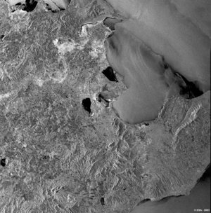
 Austria
 Belgium
 Denmark
 Spain
Spain
 Estonia
 Finland
 France
 Greece
 Hungary
 Ireland
 Italy
Italy
 Luxembourg
 Norway
 The Netherlands
 Poland
 Portugal
 Czechia
 Romania
 United Kingdom
 Slovenia
 Sweden
 Switzerland
Science & Exploration
Exploring our Solar System and unlocking the secrets of the Universe
Go to topicAstronauts


Latest


Enabling & Support
Making space accessible and developing the technologies for the future
Go to topicLatest


FinlandLakes - ASAR - 23 June 2003
This Advanced Synthetic Aperture Radar (ASAR) show some of Finland's many glacial lakes for which it is famed. The largest lake in the image is Lake Paijanne in the centre of the image. Indeed, at 120 km long and between 1 to 28 km across, the lake is Finland's second largest, and the major lake of the River Kymijoki watercourse.
The lake was formed after the last glacial period 8,000 years ago, when the land began to rise with the retreat of the ice and the connection with the sea was cut.
The lake is an important water source supplying about 1 million people in the Helsinki area.
Much of the brighter areas in the image represent built up areas. 400,000 people live in the basin of Lake Paijanne, many of which live near the shores. The towns of Kaipola, Padasjoki and Sysma can be seen.
Technical Information:
Instrument: Advanced Synthetic Aperture Radar (ASAR)
Date of Acquisition: 23 June 2003
ASAR Features: Image Mode Precision (30 meter resolution)
ASAR Mode: Image Swath 2 (104.8 km wide)
Orbit Direction: Ascending
ASAR Polarisation: VV
Orbit number: 06867
Coordinates:
NE Lat/Long: N 62.25 / 26.34 E
NW Lat/Long: N 62.00 / 24.39 E
SW Lat/Long: N 61.08 / 24.95 E
SE Lat/Long: N 61.33 / 26.84 E