About ESA
The European Space Agency (ESA) is Europe’s gateway to space. Its mission is to shape the development of Europe’s space capability and ensure that investment in space continues to deliver benefits to the citizens of Europe and the world.
Highlights


Latest


Space in Member States
Find out more about space activities in our 23 Member States, and understand how ESA works together with their national agencies, institutions and organisations.
 Germany
 Austria
 Belgium
 Denmark
 Spain
Spain
 Estonia
 Finland
 France
 Greece
 Hungary
 Ireland
 Italy
Italy
 Luxembourg
 Norway
 The Netherlands
 Poland
 Portugal
 Czechia
 Romania
 United Kingdom
 Slovenia
 Sweden
 Switzerland
Science & Exploration
Exploring our Solar System and unlocking the secrets of the Universe
Go to topicAstronauts


Latest


Enabling & Support
Making space accessible and developing the technologies for the future
Go to topicLatest


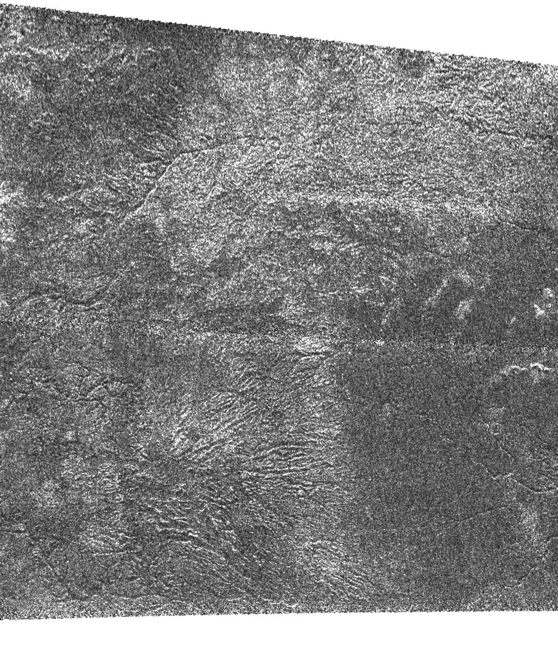
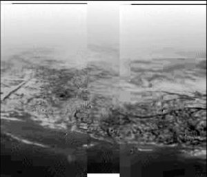
Rain drainage channels on Titan?
This NASA/ESA/ASI Cassini Synthetic Aperture Radar image of Titan was taken on 7 September 2005, from a distance of 2000 kilometres from Titan. It is located near 48 degrees South, 14 degrees West and shows an areas about 240 kilometres across.
In contrast to the image of the 'canyonlands' of Titan, this bright terrain is cut by channels that are variable in width; they form both radial and branching networks. Such patterns are reminiscent of networks formed by rainfall on Earth.
At the bottom of the frame, the channels radiate from a possible source into a dark, smooth region that seems flatter and more plain-like. One interpretation is that the higher, rougher terrain has been cleansed of organic debris and eroded by methane rainfall. The removed material has then been deposited into the lower plains.