Accept all cookies Accept only essential cookies See our Cookie Notice

About ESA
The European Space Agency (ESA) is Europe’s gateway to space. Its mission is to shape the development of Europe’s space capability and ensure that investment in space continues to deliver benefits to the citizens of Europe and the world.
Highlights
ESA - United space in Europe
This is ESA ESA facts Member States & Cooperating States Funding Director General Top management For Member State Delegations European vision European Space Policy ESA & EU Space Councils Responsibility & Sustainability Annual Report Calendar of meetings Corporate newsEstablishments & sites
ESA Headquarters ESA ESTEC ESA ESOC ESA ESRIN ESA EAC ESA ESAC Europe's Spaceport ESA ESEC ESA ECSAT Brussels Office Washington OfficeWorking with ESA
Business with ESA ESA Commercialisation Gateway Law at ESA Careers Cyber resilience at ESA IT at ESA Newsroom Partnerships Merchandising Licence Education Open Space Innovation Platform Integrity and Reporting Administrative Tribunal Health and SafetyMore about ESA
History ESA Historical Archives Exhibitions Publications Art & Culture ESA Merchandise Kids Diversity ESA Brand Centre ESA ChampionsLatest
Space in Member States
Find out more about space activities in our 23 Member States, and understand how ESA works together with their national agencies, institutions and organisations.
Science & Exploration
Exploring our Solar System and unlocking the secrets of the Universe
Go to topicAstronauts
Missions
Juice Euclid Webb Solar Orbiter BepiColombo Gaia ExoMars Cheops Exoplanet missions More missionsActivities
International Space Station Orion service module Gateway Concordia Caves & Pangaea BenefitsLatest
Space Safety
Protecting life and infrastructure on Earth and in orbit
Go to topicAsteroids
Asteroids and Planetary Defence Asteroid danger explained Flyeye telescope: asteroid detection Hera mission: asteroid deflection Near-Earth Object Coordination CentreSpace junk
About space debris Space debris by the numbers Space Environment Report In space refuelling, refurbishing and removingSafety from space
Clean Space ecodesign Zero Debris Technologies Space for Earth Supporting Sustainable DevelopmentLatest
Applications
Using space to benefit citizens and meet future challenges on Earth
Go to topicObserving the Earth
Observing the Earth Future EO Copernicus Meteorology Space for our climate Satellite missionsCommercialisation
ESA Commercialisation Gateway Open Space Innovation Platform Business Incubation ESA Space SolutionsLatest
Enabling & Support
Making space accessible and developing the technologies for the future
Go to topicBuilding missions
Space Engineering and Technology Test centre Laboratories Concurrent Design Facility Preparing for the future Shaping the Future Discovery and Preparation Advanced Concepts TeamSpace transportation
Space Transportation Ariane Vega Space Rider Future space transportation Boost! Europe's Spaceport Launches from Europe's Spaceport from 2012Latest
Puglia, Italy
Thank you for liking
You have already liked this page, you can only like it once!
Part of Puglia, or Apulia, a region in southern Italy, is featured in this image captured by the Copernicus Sentinel-2 mission.
Zoom in to see this image at its full 10 m resolution or click on the circles to learn more about the features in it.
Puglia, the heel of the boot-shaped country, has the longest coastline of any Italian mainland region. Covering almost 20 000 sq km, it is Italy’s seventh largest region and its coastline, dotted with some of Italy’s finest sandy beaches and azure seas, runs for around 800 km. With a population of around four million, Puglia borders the Adriatic Sea to the east and the Ionian Sea to the west.
Puglia is the least mountainous region of Italy, consisting of broad plains and low-lying hills. It is home to two national parks, the Alta Murgia National Park and Gargano National Park. The area is one of the largest and most productive plains in Italy where a significant amount of both wine and olive oil is produced.
Puglia’s chief town is Bari (not visible in the image), which is the largest urban and metropolitan area on the Adriatic. Major cities in the image include Brindisi, easily identifiable as a major port town on the Adriatic coast, and Lecce, an urban sprawl straddling both the Adriatic and Ionian coasts. Lecce has a large historical centre that includes the famous Piazza del Duomo square and many Baroque-style buildings dating from the 16th century—including the Basilica di Santa Croce.
Another historical seaside town and port is Otranto, visible about 40 km from Lecce on the Adriatic Sea. On a clear day, it's possible to see Albania over the Otranto Strait.
The seaside town of Gallipoli can be seen on the Ionian coast, in the bottom of the image. The old town centre sits on a tiny island connected to the mainland by a 17th century bridge.
As well as providing detailed information about Earth’s vegetation, the Copernicus Sentinel-2 mission is designed to play a key role in mapping differences in land cover to understand the landscape, map how it is used and monitor changes over time.
This image, captured on 19 January 2022, is also featured on ESA’s Earth from Space video programme.
-
CREDIT
contains modified Copernicus Sentinel data (2022), processed by ESA -
LICENCE
CC BY-SA 3.0 IGO or ESA Standard Licence
(content can be used under either licence)

Earth from Space: Heel of Italy

Earth from Space: Puglia, Italy

Earth from Space: Pollino National Park, Italy

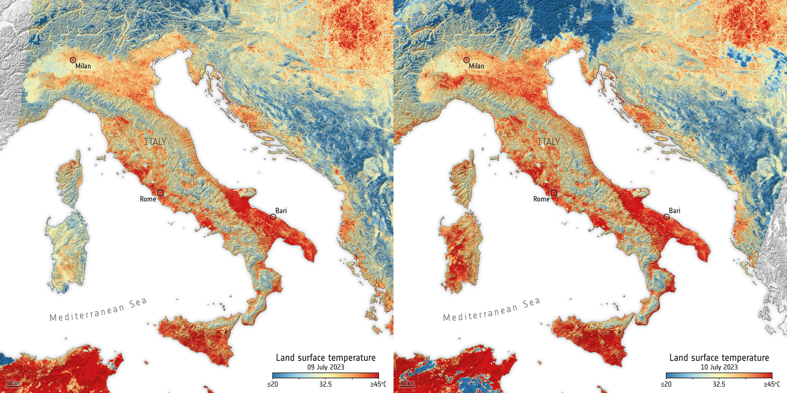
Land-surface temperature in Italy


 Germany
 Austria
 Belgium
 Denmark
 Spain
Spain
 Estonia
 Finland
 France
 Greece
 Hungary
 Ireland
 Italy
Italy
 Luxembourg
 Norway
 The Netherlands
 Poland
 Portugal
 Czechia
 Romania
 United Kingdom
 Slovenia
 Sweden
 Switzerland


