About ESA
The European Space Agency (ESA) is Europe’s gateway to space. Its mission is to shape the development of Europe’s space capability and ensure that investment in space continues to deliver benefits to the citizens of Europe and the world.
Highlights


Latest


Space in Member States
Find out more about space activities in our 23 Member States, and understand how ESA works together with their national agencies, institutions and organisations.
 Germany
 Austria
 Belgium
 Denmark
 Spain
Spain
 Estonia
 Finland
 France
 Greece
 Hungary
 Ireland
 Italy
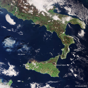
Italy
 Luxembourg
 Norway
 The Netherlands
 Poland
 Portugal
 Czechia
 Romania
 United Kingdom
 Slovenia
 Sweden
 Switzerland
Science & Exploration
Exploring our Solar System and unlocking the secrets of the Universe
Go to topicAstronauts


Latest


Enabling & Support
Making space accessible and developing the technologies for the future
Go to topicLatest


Earth from Space: Pollino National Park, Italy
Part of southern Italy is featured in this wintery image, captured by the Copernicus Sentinel-2 mission.
Zoom in to explore this image at its full resolution or click on the circles to learn more.
With the Ionian Sea to the east and the Tyrrhenian Sea to the west, the image features parts of Basilicata, Calabria and Puglia.
Lying between the two seas, this area is prone to extreme weather such as flooding. In January and February 2023, southern Italy experienced a period of unsettled weather, resulting in heavy rainfall and snow, even at low altitudes.
The image, acquired on 24 January 2023, shows the southern end of the Apennine Mountains covered with snow. The sandy colour of some of the rivers flowing down the mountain slopes depicts them carrying sediment, which is discharged into the sea. This has resulted in sediment plumes, which are clear to see along both the Tyrrhenian and Ionian coastlines.
The image also features several protected areas and two national parks, including the Pollino National Park. This is a UNESCO Geopark and Italy’s largest protected area. It covers almost 200 000 hectares between Calabria and Basilicata. The Pollino area is also home to several high mountains, the highest being the Serra Dolcedorme, which reaches 2267 m. It is visible, covered with snow, in the centre of the image.
North of the mountain peak, the Monte Cotugno artificial lake can be seen. Its waters appear green because of the high concentration of sediment.
In the top right corner of the image, a few small towns, visible in shades of brown, are dotted along the Ionian coast. The elongated green patches between the towns denote pine forests that give rise to pockets of biodiversity.