Accept all cookies Accept only essential cookies See our Cookie Notice

About ESA
The European Space Agency (ESA) is Europe’s gateway to space. Its mission is to shape the development of Europe’s space capability and ensure that investment in space continues to deliver benefits to the citizens of Europe and the world.
Highlights
ESA - United space in Europe
This is ESA ESA facts Member States & Cooperating States Funding Director General Top management For Member State Delegations European vision European Space Policy ESA & EU Space Councils Responsibility & Sustainability Annual Report Calendar of meetings Corporate newsEstablishments & sites
ESA Headquarters ESA ESTEC ESA ESOC ESA ESRIN ESA EAC ESA ESAC Europe's Spaceport ESA ESEC ESA ECSAT Brussels Office Washington OfficeWorking with ESA
Business with ESA ESA Commercialisation Gateway Law at ESA Careers Cyber resilience at ESA IT at ESA Newsroom Partnerships Merchandising Licence Education Open Space Innovation Platform Integrity and Reporting Administrative Tribunal Health and SafetyMore about ESA
History ESA Historical Archives Exhibitions Publications Art & Culture ESA Merchandise Kids Diversity ESA Brand Centre ESA ChampionsLatest
Space in Member States
Find out more about space activities in our 23 Member States, and understand how ESA works together with their national agencies, institutions and organisations.
Science & Exploration
Exploring our Solar System and unlocking the secrets of the Universe
Go to topicAstronauts
Missions
Juice Euclid Webb Solar Orbiter BepiColombo Gaia ExoMars Cheops Exoplanet missions More missionsActivities
International Space Station Orion service module Gateway Concordia Caves & Pangaea BenefitsLatest
Space Safety
Protecting life and infrastructure on Earth and in orbit
Go to topicAsteroids
Asteroids and Planetary Defence Asteroid danger explained Flyeye telescope: asteroid detection Hera mission: asteroid deflection Near-Earth Object Coordination CentreSpace junk
About space debris Space debris by the numbers Space Environment Report In space refuelling, refurbishing and removingSafety from space
Clean Space ecodesign Zero Debris Technologies Space for Earth Supporting Sustainable DevelopmentApplications
Using space to benefit citizens and meet future challenges on Earth
Go to topicObserving the Earth
Observing the Earth Future EO Copernicus Meteorology Space for our climate Satellite missionsCommercialisation
ESA Commercialisation Gateway Open Space Innovation Platform Business Incubation ESA Space SolutionsEnabling & Support
Making space accessible and developing the technologies for the future
Go to topicBuilding missions
Space Engineering and Technology Test centre Laboratories Concurrent Design Facility Preparing for the future Shaping the Future Discovery and Preparation Advanced Concepts TeamSpace transportation
Space Transportation Ariane Vega Space Rider Future space transportation Boost! Europe's Spaceport Launches from Europe's Spaceport from 2012Latest
Earth from Space: Pilbara, Western Australia
Thank you for liking
You have already liked this page, you can only like it once!
The Copernicus Sentinel-2 mission takes us over part of the northern coast of the Pilbara region in Western Australia.
Zoom in to explore this image at its full 10 m resolution or click on the circles to learn more.
As the image shows, the coast is a complex system of deltas, limestone barrier islands, salt ponds and lagoons.
Captured on 5 March 2023 and processed in false-colour, the image offers information on vegetation. The processing involved using the mission’s near-infrared channel to help highlight the distribution, density and health of the vegetation in red. The healthier the plants are, the brighter red they appear.
On the left, tidal channels and mangroves are also visible in red. Mangroves play an important role in preventing erosion and protecting the coastline from waves and storms.
Round islands can be seen in the coastal lagoons. These are in contrast to the rectangular, white and blue ponds of the salt extraction industry in the Onslow Salt Lake to the east. Causeways divide the lake into three zones which help with the evaporation process.
North of the Lake lies the coastal city of Onslow, with its airport clearly visible to the south of the city.
In the bottom centre of the image, numerous catchments that collect water after rain are visible in gold – gold partly due to the presence of mud.
Off the coast, a number of islands are scattered in the dark blue Indian Ocean waters. Their red appearance means that they are covered in vegetation. In fact, Pilbara islands are home to various nature reserves. Thevenard Island, the bigger island in the centre top of the image, is important for a wealth of marine wildlife such as sea turtles, dolphins, whales and fish.
This image was selected, processed and planned for publication prior to the news that Cyclone Ilsa was heading for Western Australia. Reports state that it subsequently made landfall as a category 5 storm at a remote stretch of the coast, thankfully missing highly-populated areas.
-
CREDIT
contains modified Copernicus Sentinel data (2023), processed by ESA -
LICENCE
CC BY-SA 3.0 IGO or ESA Standard Licence
(content can be used under either licence)

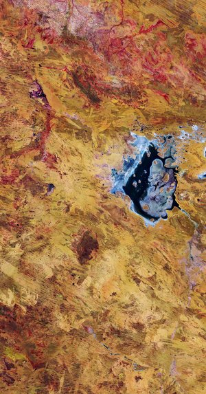
Lake Disappointment, Australia

Valentine Island, Australia

Perth, Australia

Floods in Western Australia


 Germany
 Austria
 Belgium
 Denmark
 Spain
Spain
 Estonia
 Finland
 France
 Greece
 Hungary
 Ireland
 Italy
Italy
 Luxembourg
 Norway
 The Netherlands
 Poland
 Portugal
 Czechia
 Romania
 United Kingdom
 Slovenia
 Sweden
 Switzerland


