Forandring af kystlinien Donau-deltaetOlieforurening fra borerigSkovrydning Bardia National ParkCongobækkenetKameng-Sonitpur Elephant ReserveKilimanjaroRondoniaShillong og GuwahatiIs Antarktis 2003Klimaforandringer og gletsjereGletscheres tilbagesmeltning i AlperneGletsjerisens bevægelseGletsjeranalyse ved hjælp af radarbillederMonitorering af gletschere i HimalayaTelemåling af is og sneUrbanisering CairoCordobaKathmanduHimalayaKathmandudalenLagosVegetation Annapurna Conservation AreaForsvundet i AndesbjergeneNgorongoro Conservation AreaNiger-indlandsdeltaetSydamerika
|  | | | | | | | Article Images |  |
Øvelse 2 - Styr isbryderen gennem isen med brug af billeder og kort
| | | | | Icebreaker 'Kapitan Khlebnikov' in Arctic ice en rout to Wrangel Island.
Credits: Roderick Eime | |  |  | |
| | | | | This radar image has been analysed and a ship track proposed - You can do now the same for the image of Antarctica.
Credits: ESA | | | | |
| | | | | Extract of the quicklook of the image taken on 21 November 2002 by MERIS in visible wavelength showing a dense cover of clouds.
Credits: ENIVSAT/MERIS | | | | |
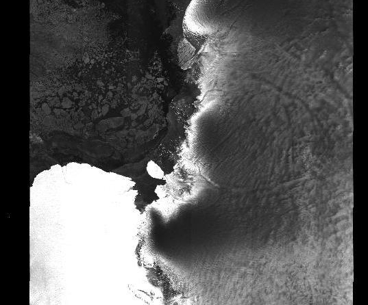
| | | | | Image taken on 21 November 2002 by ASAR, in microwave wavelength penetrating the clouds.
Credits: ENIVSAT/ASAR | | | | |
| |
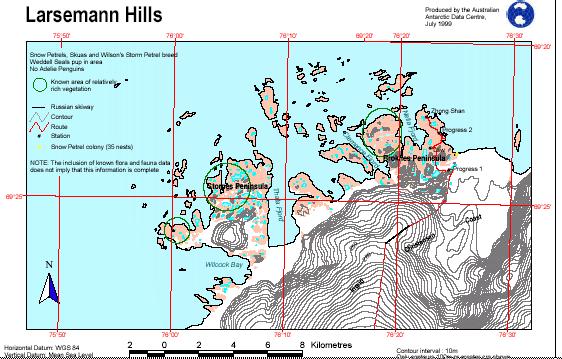
| | Antarktis ekspeditionen 2003 IndledningBaggrundØvelser IndledningØvelse 1 - Ledsag en klassekammeratØvelse 3 - Styr isbryderen gennem isen med brug af computerØvelse 4 - Hjælp, isbryderen sidder fast!Links Australian Antarctic DivisionMaps Larsemann HillsDavis station - webcamEduspace - Software LEOWorks 3Eduspace - Download ant2003_ex03.jpgant2003_ex08.jpgant2003_ex09.jpgant2003_ex10.jpgant2003_ex11.jpgant2003_ex12.jpgant2003_ex03.txt
|


