19 March
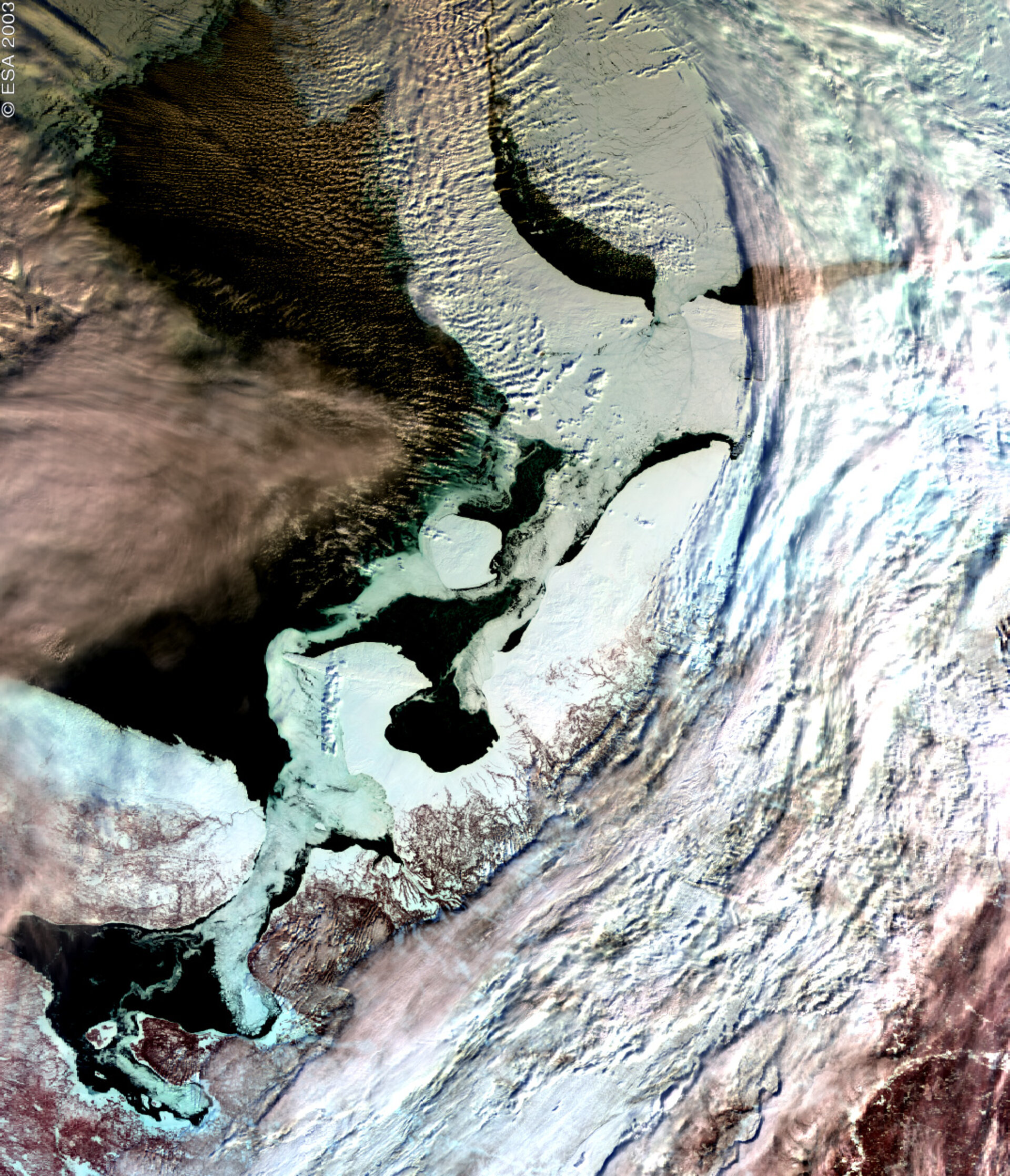
2003: On 19 March 2003, ESA published the first Medium resolution Imaging Spectrometer (MERIS) image obtained via the Artemis data-relay satellite.
The image had been acquired on the morning of 13 March over northern Russia. The area shows the coastline around the White Sea, with the City of Archangel to the southwest, opening up into the Barents Sea.
The most prominent aspect of the image is the differentiation between the sea ice, clouds and the open water. Open water in the image is shown as black, where the white/grey areas in the sea represent sea ice. The sea ice can be made out clearly against the land masses particularly around the Kanin Peninsula and to the northeast.


 Germany
 Austria
 Belgium
 Denmark
 Spain
Spain
 Estonia
 Finland
 France
 Greece
 Hungary
 Ireland
 Italy
Italy
 Luxembourg
 Norway
 The Netherlands
 Poland
 Portugal
 Czechia
 Romania
 United Kingdom
 Slovenia
 Sweden
 Switzerland


