Germany
 Austria
 Belgium
 Denmark
 Spain
Spain
 Estonia
 Finland
 France
 Greece
 Hungary
 Ireland
 Italy
Italy
 Luxembourg
 Norway
 The Netherlands
 Poland
 Portugal
 Czechia
 Romania
 United Kingdom
 Slovenia
 Sweden
 Switzerland


Forests
Originally the Earth had some 6.2 billion ha of forests, yet today less than a third of the Earth’s land surface is covered with trees. Deforestation has become particularly acute in the last few decades and according to some estimates, almost half of the world's tropical forests have been lost since the 1960s.
Forests are invaluable. They act as the world’s lungs, absorbing the greenhouse gas carbon dioxide and converting it into oxygen; their roots help to prevent soil erosion and water runoff; and their trunks and branches act as windbreaks. Forests are also a source of food, wood for building, fuel for cooking and heating, and home to more of the world’s plant and animal species than any other habitat.
Although the amount of forests is constantly decreasing due to fires, storms and encroachment onto forest land, of equal concern to foresters is the degradation of many of the world’s forests, leading to their inability to provide the goods and services demanded of them.

Now that Envisat is in orbit, invaluable data will be available to help protect this important resource. For the first time, by combining multi-source data from ASAR, AATSR and MERIS, it will be possible to derive bio-geo information worldwide that can distinguish between forest cover, clear-cut logging and agricultural land, as well as monitor land-use changes. This will help to assess forest damage, and to quantify wood supply and production. Plus, in areas which are at risk and/or difficult to access, Envisat data can be used to provide reports every three days on how forest cover is changing.
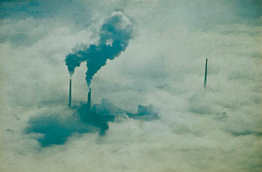
One of the greatest threats to our environment are forest fires - sometimes of natural origin but more often than not started deliberately. Each year thousands of trees all over the world literally go up in smoke. In Australia, at the beginning of 2002, fires burnt 1932 km of forests and shrub land across the state of New South Wales, shrouding Sydney in a pall of smoke. Every summer Europe braces itself for a spate of forest fires, particularly in Mediterranean areas.
AATSR, on board Envisat, is able to detect the hot spots caused by forest fires and monitor the effects of the smoke particles floating in the highest layers of the atmosphere. Other instrument on board - MIPAS and SCHIAMACHY – can track the trace gases and aerosols which are the telltale signs of the large-scale burning of biomass. Help from space is now at hand to help the world's firefighters.