CryoSat Mission Scientist: interview with Mark Drinkwater
As ESA’s Mission Scientist for CryoSat, Mark Drinkwater’s role in supporting the preparation of the mission has been to ensure that the satellite and data processing systems are compatible with achieving the mission’s objectives of deriving accurate measurements of ice-thickness change.

Mark Drinkwater, a British national, trained as a geophysicist and performed early pioneering research in the use of altimeter measurements over polar ice. He currently heads the Mission Science Division at ESA-ESTEC in the Netherlands. The division is tasked with supplying scientific and technical support to the preparation, approval and development of ESA’s Earth observation missions, including the series of scientific Earth Explorers and the Global Monitoring for Environment and Security (GMES) Sentinels.
Mark obtained a BSc from the University of Durham and a PhD in Geophysics from the University of Cambridge in the UK.
ESA: What is the role of ESA’s Mission Science Division?
Mark Drinkwater
The Mission Science Division is responsible for the scientific and technical studies needed to advance the use and contribution of new Earth observation mission data to Earth system science. A Mission Scientist is appointed in the division to deliver scientific support throughout the early consolidation of a proposed satellite mission concept. Once a mission like CryoSat is approved, the Mission Scientist establishes and coordinates an Advisory Group comprising non-ESA scientific experts to provide scientific and technical advice throughout the mission’s design and development phases.
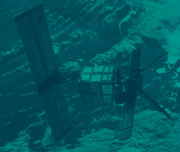
We also remain active on other missions such as Envisat and MetOp. One of our jobs is to gather and apply experience gained from the scientific exploitation of these missions for the benefit of future missions. For instance, radar altimeters flown on the ERS satellites and Envisat were primarily designed for operation over the ocean and not optimised for the study of polar ice. Scientific and technical studies were launched to improve our understanding of what is needed to address the range of effects of climate change in the polar regions. These early studies helped to identify the technical limitations of earlier satellite instruments and paved the way for a new generation of altimeter.
In 1998, the CryoSat Earth Explorer mission proposal employed these new developments, while building on ESA’s long heritage in polar orbiting altimetry. It is clear that well-coordinated scientific and technical preparatory studies are essential to demonstrate how new technologies lead to a better scientific mission.
ESA: How does CryoSat differ from previous radar altimeter missions?
Mark Drinkwater
Conventional radar altimeters carried on ERS-2 and Envisat rely on transmitting a series of pulses spaced at intervals of time. The individual signal echoes, which reflect off the ice surface back to the satellite, must be averaged to extract measurements of elevation or height of the surface. This means that the averaging increases the separation of measurements along the path of the satellite, resulting in heights spaced at intervals of around a kilometre across Earth’s surface.
To obtain denser sampling, the new CryoSat SIRAL radar transmits rapid bursts of pulses, where the corresponding echoes are much more closely spaced in time. On a flat surface, heights are resolved at intervals of 250 m along the ground track of the satellite. In addition, the specialised SIRAL radar operates in different modes to measure both ice floating in the oceans and ice on land.
ESA: Can you explain how the radar altimeter’s different modes work?
Mark Drinkwater
The Synthetic Aperture Radar (SAR) mode is an extremely important innovation for deriving sea-ice thickness in the Arctic Ocean. CryoSat measures, down to centimetres, the height of sea ice above the waterline – commonly known as 'freeboard'. To derive the thickness of pieces of floating ice, ice-surface elevation measurements must be compared to the level of the ocean surface. However, in the Arctic winter pack ice, open water is only visible in rather narrow cracks or 'leads'. For this reason, the SAR mode was designed to detect the height in these very small areas of exposed ocean. Once the freeboard is measured, we convert this quantity into ice thickness using knowledge of the density of ice.
Conventional radar altimeters fail to track the surface effectively over the rugged edges of polar ice sheets such as Greenland and Antarctica. Over variable sloping terrain, the echo may come from an unknown location off to the side of the altimeter ground track. Therefore, the distance does not translate into a 'true' elevation of the surface. This means it is not presently possible to generate an accurate elevation map from conventional radar altimetry data over the steeply sloping edges of the ice sheet. The paradox is that these locations around the edges of Greenland and Antarctica are experiencing the most rapid changes.
To address this problem, CryoSat exploits a new altimeter capability called interferometry – which means that twin antennas capture surface echoes near-simultaneously. This allows us to calculate the angle of arrival of each echo, and therefore the correct distance to the surface. This interferometry mode specifically targets steeply sloping terrain around the coastal margins of the large polar ice sheets. Importantly, it will potentially also give us the capability to look at relatively smaller ice caps and large mountain glaciers around the world, which are known to be rapidly wasting under the effects of global warming.
ESA: With CryoSat close to launching, is your role in the project now over?
Mark Drinkwater
The CryoSat-2 rebuild is a resounding positive response to the overwhelming support received after the tragic launch failure in October 2005. In many senses, a rebuild effort does not require the intensive assistance from the Mission Science Division, more characteristic of the design and development phases of the original CryoSat.
Nevertheless, throughout the preparation of CryoSat-2, the Mission Science Division has been very active in keeping the preparatory efforts of the scientific community alive. Over the last four or five years, several airborne campaigns have been organised with the intent of preparing for the post-launch commissioning phase of the satellite. During these campaigns, a number of techniques have been prepared for comparing airborne and ground measurements with the satellite data, to verify whether CryoSat is meeting its intended objectives. We have an extensive series of experiments planned over the next two years, both in the Arctic and Antarctic. These independent experiments, timed specifically to coincide with CryoSat measurements, will help to calibrate the SIRAL instrument. They will also allow us to establish the accuracy and the validity of the height measurements over the lifetime of the mission.
ESA: How did you end up working in this field?
Mark Drinkwater
I began a career in polar science with PhD research at the Scott Polar Research Institute, Cambridge University. The institute has a rich tradition in polar science, and was founded as a memorial to Robert Falcon Scott after his ill-fated expedition to the South Pole in 1912. I became interested in the polar applications of radar altimeters during my work supporting ESA’s preparation of the ERS-1 altimeter. These studies became part of my research into satellite radar altimetry of polar ice surfaces.
Whilst studying for my PhD, I was involved with a UK airborne altimeter instrument flown on a NASA research aircraft over the Svalbard and Greenland ice sheets and sea ice in the Greenland and Bering Seas in the Arctic. At the conclusion of my research, the NASA connections enabled me to pursue further research at the Jet Propulsion Laboratory, California Institute of Technology, financed by the USA National Academy of Sciences and NASA. Finally, it was the opportunity to help prepare CryoSat that encouraged me to return to Europe, to ESTEC in 2000.
CryoSat is certainly going to put hard evidence on the table
ESA: How has radar altimetry contributed to the study of polar regions?
Mark Drinkwater
In terms of what is happening at the poles, the ERS and Envisat altimetry dataset is gold dust. ESA has assembled one of the longest continuous satellite datasets (19 years) of changes in the large ice sheets, and this is of fundamental importance to our understanding their fundamental role in global sea level rise.
The more satellite data we have on climate changes at the poles, the more complicated a picture we find. What we observe is that warming results in greater snowfall and, thus, thickening of some parts of the central Antarctic and Greenland ice sheets. In stark contrast, however, the edges of ice sheets – which experience the greatest impact from warming of the oceans and atmosphere – are thinning at a rate far exceeding what had previously been predicted. Altimetry is proving absolutely essential to disentangling the climate-related variations in these remote regions.
Sea ice forms a missing link in this puzzle because current altimeters are not well equipped to measure it. CryoSat will provide unequivocal evidence as to what is actually going on. It will provide information on seasonal and year-to-year variations in the volume of ice surviving the summer months in the Arctic Ocean.
Really, that’s the essence of an Earth Explorer mission, having a bold yet singular scientific objective in mind – in this case the relationship between variations in ice and climate.
We have been carefully planning to safeguard continuity of the measurements pioneered by the ERS, Envisat and CryoSat missions. Sentinel-3 has an altimeter based on the second-generation instrument developed for CryoSat. Establishing this continuity with Sentinel-3 has enabled the links between ice sheet changes and sea level feature prominently in the new ESA Global Monitoring of Essential Climate Variables programme.
ESA: How does it feel, being in the run-up to the CryoSat launch?
Mark Drinkwater
After our heart-wrenching experience of failure in 2005, it is not surprising I am nervous about the CryoSat-2 launch. But I am energised by the fact that the CryoSat mission has assumed even greater importance, after the United Nations and recent Copenhagen acknowledgements of key issues such as the link between global warming, polar ice melt and sea level rise. Right now, the spotlight is turned squarely on CryoSat. I am happy and proud to say that ESA is contributing to such critical global issues.
Editor's note:
This is one in a series of interviews with a few of the key people that are involved in the CryoSat mission. Please check back as the list will be added to over the coming weeks.


 Germany
 Austria
 Belgium
 Denmark
 Spain
Spain
 Estonia
 Finland
 France
 Greece
 Hungary
 Ireland
 Italy
Italy
 Luxembourg
 Norway
 The Netherlands
 Poland
 Portugal
 Czechia
 Romania
 United Kingdom
 Slovenia
 Sweden
 Switzerland


