Revealing invisible Himalaya glacier loss
New research reveals that ice being lost from glaciers that flow into lakes in the Himalayas has been significantly underestimated. This discovery has critical implications for predicting the demise of the region’s glaciers and for managing critical water resources.
Glaciers in the Himalayas are part of the ‘third pole’, so-called because ice fields in high-mountain Asia contain the largest reservoir of freshwater outside the polar regions. As a whole, the third pole provides freshwater for over 1.3 billion people in Asia.
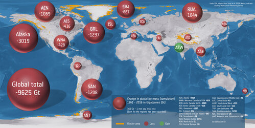
Climate change isn’t only causing ice to be lost from the polar regions, but also from glaciers in these high mountains. And, with millions relying on water from this mountain ice, it’s important to understand and predict how this precious resource might be affected in the future.

The new findings, which were published in the journal Nature Geoscience this week, found that values of ice lost from Himalayan glaciers that terminate in lakes during 2000 to 2020 were, on average, underestimated by 6.5%.
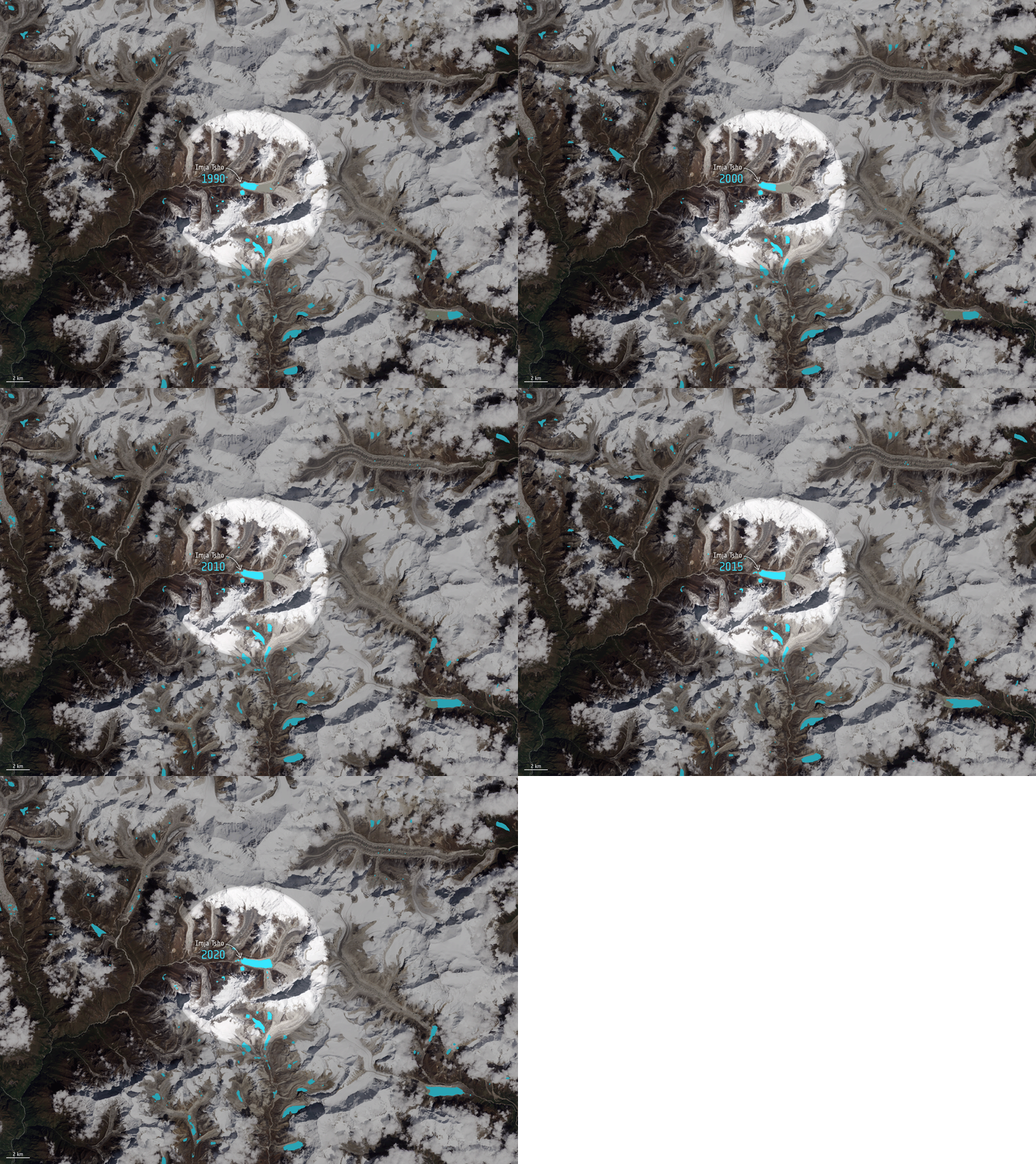
Digital elevation models based on satellite data have been used widely to estimate ice loss from glaciers. However, meltwater from glaciers often ends up as proglacial lakes – lakes that form in front of the ice. In effect, the glacial ice is replaced by lake water.
The traditional digital elevation model method of estimating ice loss measures the glacier and water surface but does not account for any ice loss that occurs below the surface of a lake.
The Himalayas and many other mountains have thousands of proglacial lakes, many of which are rapidly expanding. Yet, the contribution of subaqueous mass loss to total glacier mass loss has been largely neglected – until now.

An international team, including scientists from the Chinese Academy of Sciences and Graz University of Technology in Austria, used a long time series of satellite images, mainly from the US Landsat mission to detect changes in the outlines of lakes.
They also measured the depth of numerous proglacial lakes between 2018 and 2021 using an uncrewed surface vessel and existing bathymetry data.
From the data on the changing shape of the lakes together with the bathymetry data, the team was able to estimate the volume of water the lakes held.
The research is, in part, an outcome of the Dragon programme – a cooperation between ESA and China’s National Remote Sensing Centre that promotes the use of ESA, Third Party Mission, Copernicus Sentinel and Chinese satellite data for science and applications.
Although Landsat is a US mission, it is also an ESA Third Party Mission. Through the Third Party Missions programme, ESA offers data from a wide range of satellite missions developed and operated by other agencies.

Tobias Bolch, from Graz University of Technology in Austria and co-author of the paper, said, “While satellites provide a wealth of information about our changing world, they cannot ‘see’ underwater. We can only use satellite data to measure a lake’s surface, but not the ice below that is replaced by water.
“This had led to a gap in our understanding of the full extent of ice being lost from lake-terminating glaciers.”
Guoqing Zhang from the Chinese Academy of Sciences, and first author of the paper, explained, “From our research we now know that proglacial lakes in the region increased by 47% in number, 33% in area, and 42% in volume between 2000 and 2020.
“We estimate that this equates glacier mass loss of around 2.7 Gt, which is about the same weight as 570 million elephants, and which has not been previously accounted for.”

The most significant underestimation of 10% occurred in the central Himalaya, where glacial lake growth has been the most rapid.
“This emphasises the importance of incorporating subaqueous mass loss from lake-terminating glaciers in future mass-change estimates and glacier evolution models, regardless of the study region,” added Dr Bolch.
Tandong Yao, co-author of the paper and who also co-chairs the Third Pole Environment programme, noted, “By more accurately accounting for glacier mass loss, researchers can better predict future water resource availability in the sensitive mountain region.”


 Germany
 Austria
 Belgium
 Denmark
 Spain
Spain
 Estonia
 Finland
 France
 Greece
 Hungary
 Ireland
 Italy
Italy
 Luxembourg
 Norway
 The Netherlands
 Poland
 Portugal
 Czechia
 Romania
 United Kingdom
 Slovenia
 Sweden
 Switzerland


