About ESA
The European Space Agency (ESA) is Europe’s gateway to space. Its mission is to shape the development of Europe’s space capability and ensure that investment in space continues to deliver benefits to the citizens of Europe and the world.
Highlights


Latest


Space in Member States
Find out more about space activities in our 23 Member States, and understand how ESA works together with their national agencies, institutions and organisations.
 Germany
 Austria
 Belgium
 Denmark
 Spain
Spain
 Estonia
 Finland
 France
 Greece
 Hungary
 Ireland
 Italy
Italy
 Luxembourg
 Norway
 The Netherlands
 Poland
 Portugal
 Czechia
 Romania
 United Kingdom
 Slovenia
 Sweden
 Switzerland
Science & Exploration
Exploring our Solar System and unlocking the secrets of the Universe
Go to topicAstronauts


Latest


Enabling & Support
Making space accessible and developing the technologies for the future
Go to topicLatest


Austria land cover
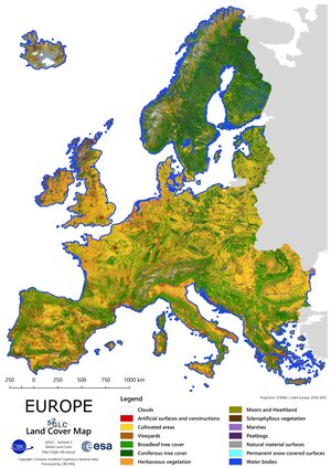
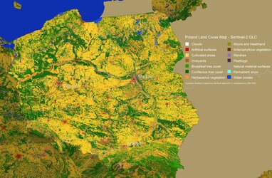
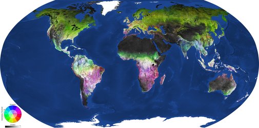
Up-to-date land-cover maps are a basic source of information to track the impact that human activity, natural processes and climate change have on land cover. They are critical for making informed policy, development and resource management decisions, and for disciplines such as agriculture, forestry, water management, urban planning, environmental protection and crisis management.
While the Copernicus Sentinel-2 mission delivers ideal images to map land cover, producing maps means that huge amounts of time-series data have to be processed. To make this possible, the ESA-funded Sentinel-2 for Science Land Cover project explored novel ways of capitalising on the latest cloud-computing technologies and machine learning to automate mapping. While still in the experimental stage, the results demonstrate that fully-automated mapping is just around the corner.