About ESA
The European Space Agency (ESA) is Europe’s gateway to space. Its mission is to shape the development of Europe’s space capability and ensure that investment in space continues to deliver benefits to the citizens of Europe and the world.
Highlights


Latest


Space in Member States
Find out more about space activities in our 23 Member States, and understand how ESA works together with their national agencies, institutions and organisations.
 Germany
 Austria
 Belgium
 Denmark
 Spain
Spain
 Estonia
 Finland
 France
 Greece
 Hungary
 Ireland
 Italy
Italy
 Luxembourg
 Norway
 The Netherlands
 Poland
 Portugal
 Czechia
 Romania
 United Kingdom
 Slovenia
 Sweden
 Switzerland
Science & Exploration
Exploring our Solar System and unlocking the secrets of the Universe
Go to topicAstronauts


Latest


Enabling & Support
Making space accessible and developing the technologies for the future
Go to topicLatest


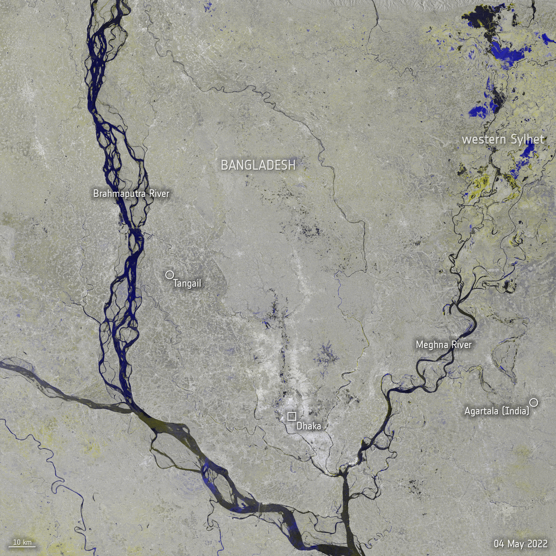
Satellites map floods in western Europe
Record rainfall has caused swollen rivers to burst their banks and wash away homes and other buildings in western Europe – leading to more than 90 casualties and over 1000 people missing. Data from the Copernicus Sentinel-1 mission are being used to map flooded areas to help relief efforts.
The German states of Rhineland-Palatinate and North Rhine-Westphalia were among the worst hit by the torrential rainfall, with water levels rising in the Rhine River, as well as the Walloon Region in Belgium. The storms and high waters have also battered neighbouring Switzerland, the Netherlands and Luxembourg.
This radar image uses information from two separate acquisitions captured by the Sentinel-1 mission on 3 July and 15 July 2021, and it shows the extent of the flooding in red. Radar images acquired before and after flooding disasters offer immediate information on the extent of inundation and have proved useful in monitoring floods, thanks to Sentinel-1’s ability to ‘see’ through clouds and rain.
The mission has been supplying imagery through the Copernicus Emergency Mapping Service to aid relief efforts. The devastating floods has triggered four activations in the Copernicus Emergency Mapping Service, in Western Germany, Belgium, Switzerland and the Netherlands.
The service uses observations from multiple satellites to provide on-demand mapping to help civil protection authorities and the international humanitarian community in the face of major emergencies.
Learn more about the Copernicus Sentinel-1 mission here.