Serving science
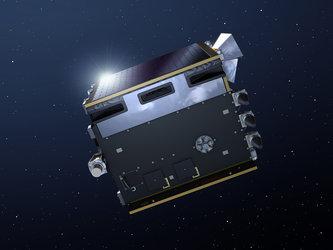
The Spot Vegetation dataset has close to 10 000 registered users around the globe and has contributed to hundreds of scientific papers over 15 years. But with further Spot satellites lacking the capacity to carry Vegetation instruments, Proba-V has been designed to meet the future needs of this group.
Vegetation can distinguish between different land cover types and plant species, including crops, to reveal their health, as well as detect water bodies and vegetation burn scars. Vegetation provides a detailed daily snapshot of land cover across a continental scale on a near-daily basis.
Vegetation is a leading source of key European and global vegetation data products (such as Leaf Area Index and Normalised Density Vegetation Index) provided to environmental researchers through European Commission programmes.
These are harnessed in turn for scientific and operational activities that range from climate impact assessments and surface water resource management to agricultural monitoring – feeding for example the MARS Bulletin on European Union crop production forecasts – and food security estimates.


 Germany
 Austria
 Belgium
 Denmark
 Spain
Spain
 Estonia
 Finland
 France
 Greece
 Hungary
 Ireland
 Italy
Italy
 Luxembourg
 Norway
 The Netherlands
 Poland
 Portugal
 Czechia
 Romania
 United Kingdom
 Slovenia
 Sweden
 Switzerland


