| | Exercise 3: Oil rig environmental disaster
There have been several serious oil spills from supertankers, and each time media attention seems to increase. It is, however, not only the huge spills that pose a threat to the environment. All minor spills, whether unintentional or caused when captains clean and wash down their oil tanks, are damaging. It has been estimated that intentional and illegal spills of this type into the oceans amount to 3 million tonnes per year. Accidents on the oil rigs and oil leaking from pipelines between offshore fields and the mainland are also sources of oil pollution of the oceans.
Not much oil is needed to cause serious damage. Oil settles like a thin film on the surface of the ocean. It can drift over vast distances, or it can break up and mix with water if the wind is strong enough. The toxic effects of oil contamination prevent the absorption of important nutrients. The loss of insulating and water-repellent properties have detrimental effects on animals. Even minor spills can cause harm, depending on the type of oil, endemic vegetation, season, wind force, etc.
 | | | ERS-2 satellite |
Satellite monitoring
70% of the Earth's surface is covered by ocean, and it is impossible to monitor the oceans with traditional methods such as buoys, ships, or aircraft. The areas are too large, and there are also problems of waves, thick clouds, and variable conditions.
However, polar orbiting satellites have proved to be very useful. They 'look' down on Earth along a broad stripe, and cover huge areas within a short period of time.
The most effective are radar satellites. An imaging radar illuminates the ground with micro-pulses, and receives the reflected energy back. The resulting image looks a bit like a black and white photo. An oil slick will often show in the picture as a dark spot or line against a grey background. Oil slicks appear dark in the satellite image because the oil makes the sea smoother, and reflection of the microwave energy back to the satellite decreases, compared to the reflection back from a clean (and comparatively rougher) sea.
In Norway, the oil monitoring service is established in cooperation with the Norwegian Pollution Control Authority (SFT) at Tromsø Satellite Station. The service is based on data from the European radar satellites ERS-1 and ERS-2, and Canada's RADARSAT. The objective of the oil monitoring service is to give the authorities information about potential oil spills within two hours of the satellite overpass.
Aeroplanes operate in coordination with the movements of the satellite. Depending on the thickness and age of an oil slick, and also on certain imaging characteristics, a slick can best be identified under windspeed conditions of between 3 and 12 m/sec. Below this level, the sea appears black, and above it the sea becomes very bright, making differentiation of the oil slick area more difficult.
Norwegian Pollution Control Authority (SFT)
Oil forms a thin film on the surface of the water. Its thickness can be as little as one molecule, about 1/100,000 mm. Try to find out how large an area of the ocean surface 10 litres of oil would cover.
| | Oil dumped during cleaning operations | |
Ship monitoring
Radar satellites have also proved to be effective in monitoring ship traffic. Ships appear as a bright point on a radar image. If the wind is not too strong (below 10 to 15 m/sec) ship wake is also visible, allowing an estimation of the ship's heading. A careful interpreter of a radar scene will also discover that often the bright point of a ship is slightly detached from the wake. This gap can be measured and used to compute the speed of the ship.
Exercise
Download the radar image taken from the ERS-1 satellite in heavy mist on 25 November 1994. The bright point in the scene looks like a ship discharging some oily material into the North Sea.
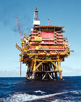
But the location was estimated, and in this instance it was found to be an oil rig. The weather was too bad for aeroplanes to go out in order to check this. A telephone call to the chief inspector of the rig confirmed that they had had an accidental spill!
The expert interpreting the image immediately figured out when the spill started and there was no way that the people involved could avoid telling the truth!
Can you find out how long the pollution went on before the satellite passed over the area and acquired the image?
In the picture you can see the rig as a bright spot and the black stripe is oil. It is bent because the wind has changed during the spill.
To do the exercise there are two more things you would need to know: you have to consider that the wind speed was 5m/sec during the whole spilling period, and you also have to know that an oil film is drifting in the wind direction only at 3% of the wind speed.
Now, please work on the following questions:
Estimate how far the oil drifted during the release.
When and how did the wind direction change after the discharge started?
Looking at the information on the picture, compute the duration of the discharge and estimate the date and time of the start of the spill. The ERS satellite was over the area on 25 November 1994 at 10:49 GMT (Orbit 17585 Frame: 2457). Produce a short report of your findings!
| |