Coastal change Danube Delta change detectionOil spillsDeforestation Bardia National ParkCongo River BasinKameng-Sonitpur Elephant ReserveKilimanjaroRondoniaShillong and GuwahatiIce Antarctica 2003Climate change and glaciersGlacier analysis using radar imageryGlacial retreat in the AlpsGlacier Ice FlowMonitoring of glaciers in the HimalayasRemote sensing of ice and snowUrbanisation CairoCity of KathmanduCórdobaHimalayasKathmandu ValleyLagosVegetation Annapurna Conservation AreaLost in the AndesNgorongoro Conservation AreaNiger Inland DeltaVegetation in South America
|  | | | | | | | Article Images |  |
Analysis of Satellite Images - Part 2
| | | | | | Kameng-Sonitpur Elephant Reserve – Forest areas cleared and converted to rice fields | |  |  | |
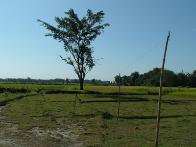
| | | | | | Kameng-Sonitpur Elephant Reserve – Live wires installed in rice fields to prevent elephants from entering rice fields and destroying crops | | | | |
| | | | | | Kameng-Sonitpur Elephant Reserve – Computing NDVI with selection of bands | | | | |
| |
| | Kameng-Sonitpur Elephant Reserve IntroductionElephant ReserveAsian elephantMan vs elephantExercises Worksheet introductionPaper map creation and study of Kameng-Sonitpur Elephant ReserveAnalysis of satellite imagesEduspace - Software LEOWorks 3ArcExplorerEduspace - Download ks_papermap.zipks_satelliteimg.zipResources Useful links
|