ESAEducationHomeWeather and ClimateGlobal ChangeNatural Disasters
    01-Apr-2025
Coastal change
Danube Delta change detectionOil spills
Deforestation
Bardia National ParkCongo River BasinKameng-Sonitpur Elephant ReserveKilimanjaroRondoniaShillong and Guwahati
Ice
Antarctica 2003Climate change and glaciersGlacier analysis using radar imageryGlacial retreat in the AlpsGlacier Ice FlowMonitoring of glaciers in the HimalayasRemote sensing of ice and snow
Urbanisation
CairoCity of KathmanduCórdobaHimalayasKathmandu ValleyLagos
Vegetation
Annapurna Conservation AreaLost in the AndesNgorongoro Conservation AreaNiger Inland DeltaVegetation in South America


printer friendly page
Exercise 2 - Guide the icebreaker through the ice using images and maps - Continued
 
Page123
 
 
Detailed map of the Larsemann's Hills
ant2003_ex12.jpg
 
Detailed map of the Larsemann's Hills.

Read the four corner coordinates of the 21 November 2002 image from the info sheet ant2003_ex03.txt, and place them precisely onto the map.

The best maps we have are the Encarta ones (ant2003_ex08.jpg and ant2003_ex09.jpg). For an overview and for the geographical names, consult ant2003_ex10.jpg.

Try to match the scale of the map and image using, for example, a photocopier. Introduce some lines of latitude and longitude into the image.

Report prominent features from the image onto the map. The other maps might help you with glacier ice boundary and shorelines.

For the landing point, look up the situation on the two following maps: ant2003_ex11.jpg and ant2003_ex12.jpg. On the top map you can find the Zhong Shan Chinese Station (see picture as well), the two Russian Stations Progress-1 and Progress-2, and, in between, the Australian Station, the Law Base Refugee (see images as well). That is where the expedition wants to go.

Now we have to precisely define the zone of ice floes on the map. In order to do this, we will take the information from the radar image. The open water channels are especially important. We have to introduce them on the map as well.

Decide on a route and mark it with a zigzag line. Try to minimise the number of turns.

The edges are our waypoint. Estimate their positions!

The lines are used to estimate the headings. Use a protractor to read the angle between the northern direction and the direction in which the ship has to steer (northwards travelling means a heading of zero degrees, eastwards is ninety degrees, etc).


Assemble your findings in a table. Check again and again. Remember, the safety of the ship and of all its passengers is in your hands!


Finally you can bring the map and the table to the captain, and you can relax and enjoy the ship making its way through the ice and observe the penguins, which are the most peculiar birds in the world. They live naturally in the cold part of the southern hemisphere.


Page123


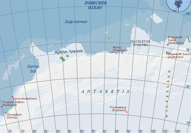
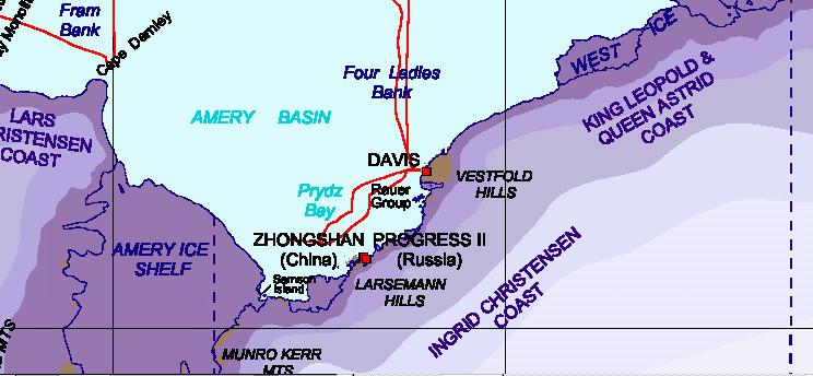
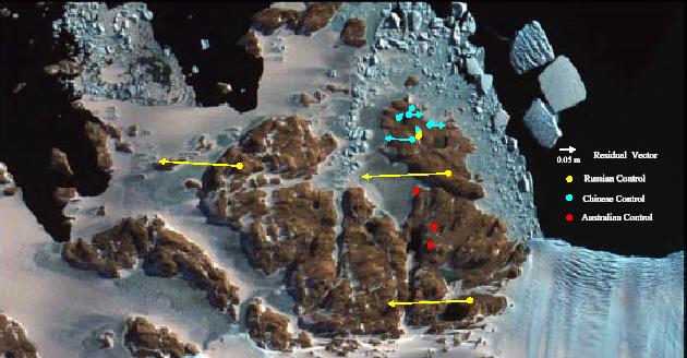
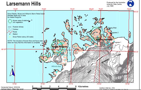
Antarctica 2003 expedition
IntroductionBackground
Exercises
IntroductionExercise 1 - Accompany a classmateExercise 2 - Guide the icebreaker through the ice using images and mapsExercise 3 - Guide the icebreaker through the ice using a computerExercise 4 - Help, the icebreaker is stuck!
Links
Australian Antarctic DivisionMaps Larsemann HillsDavis station - webcam
Eduspace - Software
LEOWorks 3
Eduspace - Download
ant2003_ex03.jpgant2003_ex08.jpgant2003_ex09.jpgant2003_ex10.jpgant2003_ex11.jpgant2003_ex12.jpgant2003_ex03.txt


   Copyright 2000 - 2014 © European Space Agency. All rights reserved.