| | Exercise 2 - Guide the icebreaker through the ice using images and maps
|  | Icebreaker 'Kapitan Khlebnikov' | |
During the Antarctica 2003 expedition, the Kaptain Khlebnikov icebreaker often had to approach the coast. These were very exciting moments, as it was sometimes very difficult to do so, as the ice was often piled up to form a barrier.
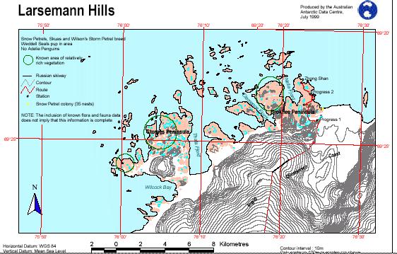
Approaching the coast has to be done cautiously. Land fall might be equally critical (see photo of the Zhong Shan Station). From the ship's bridge, visibility is limited, and even if a helicopter was available for ice surveying, this would be costly, and due to the bad weather, perhaps even impossible.
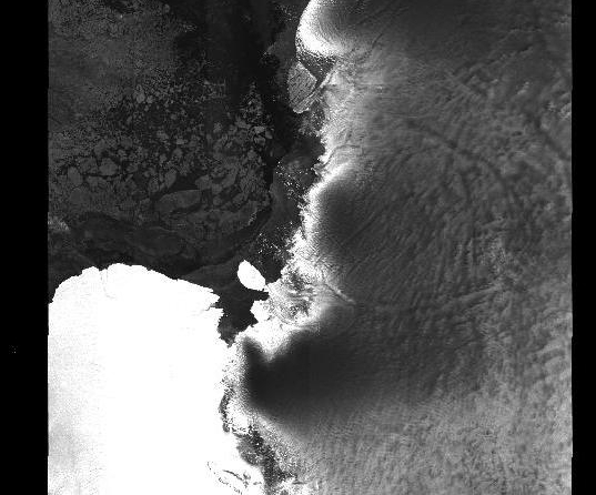
| | | This radar image has been analysed and a ship track proposed |
But you, who are travelling on the ship or the supporting team in the classroom, are in possession of an up-to-date ASAR radar image from Envisat! You have the information needed to guide the ship safely through the ice and to find a potentially suitable disembarking place near the shore to reach the research station in walking distance. Everything depends on your skill to recognise ice types and direct the ship in a way to avoid passing through thick ice and eventually getting stuck. Such a situation would delay the arrival of the ship, and the travelling comfort would be compromised by the terrible noise of the engines and the cracking ice.
As you can imagine, the safety and success of the expedition are in your hands!
What the captain of the ship would need is a route through the ice and a disembarking point. This means that you would have to provide him with waypoints (positions) and headings in degrees between these waypoints. To do this, you have to interpret the image and trace a line avoiding the floes, following the leads (ice free waters). In every turning point, that is in every change of the travelling direction of the ship, you would have to read the new heading, that is the direction in which the ship has to continue to hit the next waypoint.
| | Extract of the quicklook of the image taken on 21 November 2002 by MERIS | |
Before starting your work, we suggest that you read and study all about sea ice and how it is imaged by radar satellites. You can find lots of information in the Background chapter of this module.
The radar image we have was acquired on 21 November 2002. We could have had a similar situation in 2003 during the cruise. We also have a quicklook of an optical image from MERIS, another instrument onboard Envisat.
| | | Image taken on 21 November 2002 by ASAR |
It was taken on the same day and mostly shows clouds with some small gaps where we can spot the sea. But the radar image is clear – and we know why!
You can find information on the ASAR image acquired on 21 November 2002 by clicking on the link on the right.
| |


